Kategoria katika San
Ukweli wa San
| Area | 4744.9 km² |
| Idadi ya Watu | 407,485 |
| Idadi ya Wanaume | 202,422 (49.7%) |
| Idadi ya Wanawake | 205,063 (50.3%) |
| Mabadiliko ya idadi ya watu (1975 to 2020) | +118.8% |
| Mabadiliko ya idadi ya watu (2000 to 2020) | +51.8% |
| Umri Wastani | Miaka 15.6 (Mwanamume: 14.9, Mwanamke: 16.3) |
| wakati wa Kawaida | |
| Ukanda wa saa | Saa za Greenwich |
| Latitudo na Longitudo | 13.30335, -4.89562 |
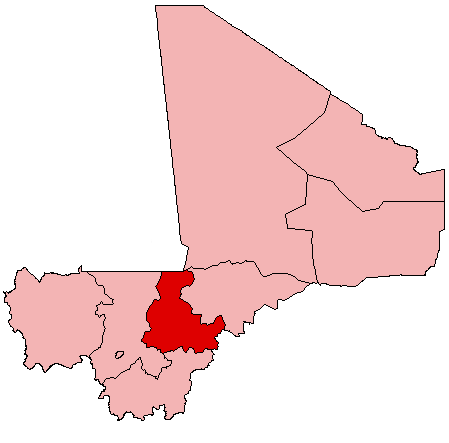
Ramani ya San
Ramani inayoingiliana
Idadi ya watu ya San
Miaka 1975 hadi 2020
| Data | 1975 | 1990 | 2000 | 2015 | 2020 |
|---|---|---|---|---|---|
| Idadi ya Watu | 186,276 | 228,948 | 268,472 | 356,877 | 407,485 |
| Uzani wa Idadi ya Watu | 39.3 / km² | 48.3 / km² | 56.6 / km² | 75.2 / km² | 85.9 / km² |
Vyanzo: JRC (European Commission's Joint Research Centre) kazi ya GHS built-up grid
Mabadiliko ya idadi ya watu ya San kutoka 2000 hadi 2015
Ongezeko la 32.9% kutoka mwaka 2000 hadi 2015
| Location | Mabadiliko tangu 1975 | Mabadiliko tangu 1990 | Mabadiliko tangu 2000 |
|---|---|---|---|
| San | +91.6% | +55.9% | +32.9% |
| Ségou Region | +129% | +78.4% | +43.1% |
| Mali | +173.2% | +108.4% | +59.6% |
Vyanzo: JRC (European Commission's Joint Research Centre) kazi ya GHS built-up grid
Umri wa wastani wa San
Umri wa wastani: miaka 15.6
| Location | Umri Wastani | Umri wa Kati (Kike) | Umri wa Kati (Mwanaume) |
|---|---|---|---|
| San | 15.6 yrs | 16.3 yrs | 14.9 yrs |
| Ségou Region | 15.6 yrs | 16.2 yrs | 14.9 yrs |
| Mali | 16.1 yrs | 16.6 yrs | 15.5 yrs |
Vyanzo: CIESIN (Center for International Earth Science Information Network)
Msongamano wa watu wa San
Msongamano wa watu: 85.9 / km²
| Location | Idadi ya Watu | Area | Msongamano |
|---|---|---|---|
| San | 407,485 | 4,744.9 km² | 85.9 / km² |
| Ségou Region | 2.7 million | 61,996.2 km² | 43.6 / km² |
| Mali | 17.7 million | 1,252,394 km² | 14.1 / km² |
Vyanzo: JRC (European Commission's Joint Research Centre) kazi ya GHS built-up grid
Idadi ya watu ya kihistoria na inayokadiriwa ya San
Idadi ya watu inayokadiriwa kutoka 300 hadi 2100
Vyanzo:
- JRC (European Commission's Joint Research Centre) kazi ya GHS built-up grid
- CIESIN (Center for International Earth Science Information Network)
- [Kiunga] Klein Goldewijk, K., Beusen, A., Doelman, J., and Stehfest, E.: Anthropogenic land use estimates for the Holocene – HYDE 3.2, Earth Syst. Sci. Data, 9, 927–953, https://doi.org/10.5194/essd-9-927-2017, 2017.
Kielelezo cha Maendeleo ya Binadamu (HDI)
Faharisi ya takwimu ya kitisho cha kuishi, elimu, na mapato ya kila mtu.
Chanzo: [Kiunga] Kummu, M., Taka, M. &Guillaume, J. Gridded global datasets for Gross Domestic Product and Human Development Index over 1990–2015. Sci Data 5, 180004 (2018) doi:10.1038/sdata.2018.4
Utoaji wa CO2 wa San
Carbon Dioxide (CO2) Uzalishaji wa hewa kwa Capita huko Tonnes kwa mwaka
| Location | Uzalishaji wa CO2 | Uzalishaji wa CO2 kwa Capita | Uzito wa uzalishaji wa CO2 |
|---|---|---|---|
| San | 56,120 tn | 0.14 tn | 11.8 tons/km² |
| Ségou Region | 372,444 tn | 0.14 tn | 6 tons/km² |
| Mali | 2,464,946 tn | 0.14 tn | 2 tons/km² |
Vyanzo: [Kiunga] Moran, D., Kanemoto K; Jiborn, M., Wood, R., Többen, J., and Seto, K.C. (2018) Carbon footprints of 13,000 cities. Environmental Research Letters DOI: 10.1088/1748-9326/aac72a
Utoaji wa CO2 wa San
| Utoaji wa CO2 wa 2013 (tani/mwaka) | 56,120 tn |
| Utoaji wa CO2 wa 2013 (tani/mwaka) kwa mtu | 0.14 tn |
| Nguvu ya utoaji wa CO2 wa 2013 (tani/km²/mwaka) | 11.8 tons/km² |
Hatari ya Hatari za Asili
Hatari ya jamaa kati ya 10
| Hatari | Ngazi ya hatari |
|---|---|
| Ukame | Wastani (5.7) |
| Mafuriko | Wastani (4) |
* Hatari, haswa juu ya mafuriko au maporomoko ya ardhi, inaweza kuwa sio kwa eneo lote.
Vyanzo:
- Dilley, M., R.S. Chen, U. Deichmann, A.L. Lerner-Lam, M. Arnold, J. Agwe, P. Buys, O. Kjekstad, B. Lyon, and G. Yetman. 2005. Natural Disaster Hotspots: A Global Risk Analysis. Washington, D.C.: World Bank. https://doi.org/10.1596/0-8213-5930-4.
- Center for Hazards and Risk Research - CHRR - Columbia University, Center for International Earth Science Information Network - CIESIN - Columbia University, and International Research Institute for Climate and Society - IRI - Columbia University. 2005. Global Drought Hazard Frequency and Distribution. Palisades, NY: NASA Socioeconomic Data and Applications Center (SEDAC). https://doi.org/10.7927/H4VX0DFT.
- Center for Hazards and Risk Research - CHRR - Columbia University, Center for International Earth Science Information Network - CIESIN - Columbia University. 2005. Global Flood Hazard Frequency and Distribution. Palisades, NY: NASA Socioeconomic Data and Applications Center (SEDAC). https://doi.org/10.7927/H4668B3D.

Kuhusu Takwimu Zetu
Data katika ukurasa huu inakadiriwa kwa kutumia zana na rasilimali kadhaa zinazopatikana hadharani. Inatolewa bila dhamana, na inaweza kuwa na makosa. Tumia kwa hatari yako mwenyewe.